We'll follow up within one business day. No pressure, no upsells.
Overview
Why Choose Complete Estate Care for Wildfire Risk Assessment and Defensible Space Inspection for Colorado Homes
A wildfire risk assessment is the on-site walk that tells you exactly where your property will fail when a fire moves through, and it's the one step that has to come before anyone sells you clearing, hardening, or a stack of invoices. Joe Slota at Complete Estate Care walks every square foot himself, maps the lot against the Colorado State Forest Service (CSFS) three-zone model, and ranks your vulnerabilities by ignition risk so you spend on Zone 0 against the foundation before anyone touches Zone 2 out at the property line. Here's the part that separates it from a free "inspection" that's really a sales walk-around: the assessment also starts the written, time-stamped record your insurer now needs under Colorado's HB25-1182. Joe does every assessment in person. No call center, no subcontractor reading a price sheet, no drive-by quote. Call (303) 304-9997 to schedule your free on-site wildfire risk assessment before fire season fills the calendar.
Most Front Range homeowners search for a "defensible space inspection" or a "wildfire defense system" after a neighbor got a non-renewal letter or an insurer flagged their risk score. The honest answer is that the inspection and the system are the same conversation: you can't design a defense you haven't measured. Complete Estate Care works out of Denver and covers the foothills and mountain counties, from Jefferson County's wildland-urban interface around Golden and Evergreen to the beetle-kill timber of Grand and Routt counties. Every lot reads differently, which is why the assessment comes first and the number comes after. Contact Complete Estate Care for an accurate, walked-the-property estimate rather than a phone quote.
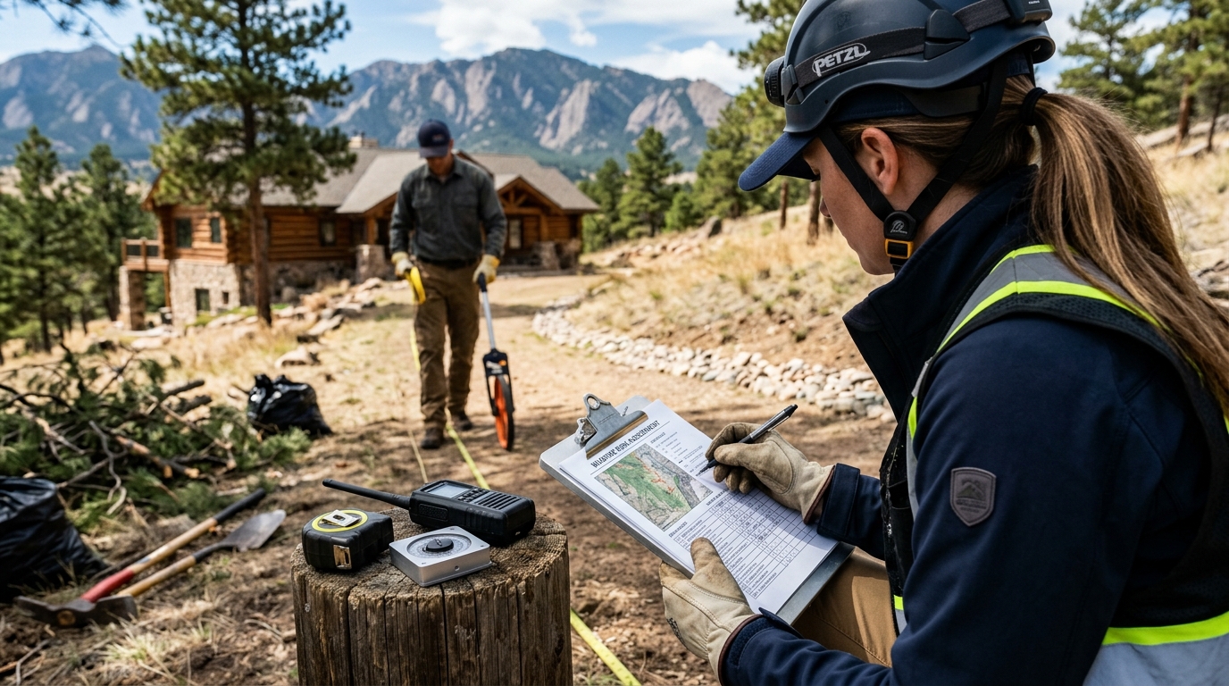
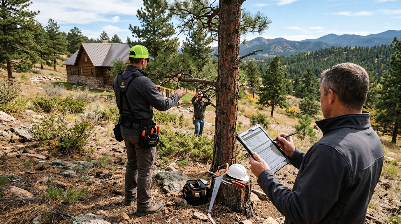
Defensible space inspection mapping fuel continuity across the zones around a Colorado foothills home
What Is a Wildfire Risk Assessment?
A wildfire risk assessment is a structured, on-site evaluation that measures how likely your home is to ignite in a wildfire and ranks exactly what to fix first. Joe walks the full property and structure, maps it against the CSFS three-zone model, flags high-hazard species like juniper inside 30 feet, and checks every ember entry point on the roof, vents, and eaves. You get a written, prioritized plan, not a sales pitch.
The assessment answers three questions in order.
First, what's your immediate ignition risk in Zone 0, the five feet against the foundation where most homes fail before Joe even reaches the back yard.
Second, where does fuel continuity carry a fire toward the structure, horizontally across the ground and vertically up through ladder fuels into the tree canopy.
Third, where will wind-blown embers get inside, since embers travel more than a mile ahead of the fire front and cause the majority of home ignitions.
Answer those three and you know what to spend money on and in what order.
What a Defensible Space Inspection Actually Covers
A real wildfire risk assessment covers the vegetation and the structure as one system, because the Home Ignition Zone treats them as one. Here's what Joe measures on every walk.
Three-zone defensible space mapping
Joe measures the Home Ignition Zone (HIZ) against the CSFS three-zone model: Zone 0 (0 to 5 feet), Zone 1 (5 to 30 feet), and Zone 2 (30 to 100-plus feet). Slope gets measured too, because fire spread rate roughly doubles for every 10 degrees of grade, so zone distances extend downhill on any foothills lot.
High-hazard vegetation inspection
Every high-hazard plant inside 30 feet gets flagged: juniper, dense resinous evergreens, cured ornamental grasses, and thicket-forming Gambel oak that builds continuous ladder fuel. Joe marks what to pull, what to thin, and what to keep, so the defensible space inspection becomes a plan you can act on, not a scare list.
Ember entry point inspection
The structure is scored opening by opening: Class A roof condition, vent screening (corrosion-resistant 1/16-inch metal mesh), eaves, deck, siding at grade, and the garage door, the largest and most overlooked ember gap on the house. This is the structural half of the system defensible space can't cover on its own.
Insurance-grade documentation, from day one
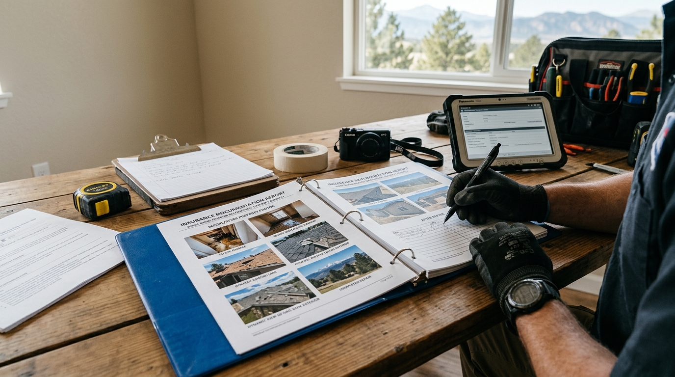
The assessment is written up with time-stamped photos and a prioritized action plan formatted so it holds up for an insurer, an HB25-1182 risk-score appeal, and the Colorado Wildfire Mitigation Tax Credit. The record starts the day Joe walks the lot, not after the work is done.
Defensible Space Inspection: Measuring Fuel, Not Counting Trees
A defensible space inspection is the vegetation half of the assessment, and it's where most "free inspections" quietly turn into a clearing bid. The difference is whether someone measured the property or just counted trees to price a job. Joe inspects fuel continuity in two directions, because that's how fire actually moves across a Colorado lot:
Horizontal continuity across the ground
This is the run of connected grass, shrubs, mulch beds, and stored firewood that lets a surface fire travel unbroken toward the house. In Zone 0 the inspection looks for anything combustible against the foundation (bark mulch, dead leaves, a woodpile on the siding). In Zone 1 it's plant spacing and whether beds are continuous or broken into separated groups.
Vertical continuity into the canopy
Ladder fuels are the low branches and saplings that bridge a ground fire up into mature tree crowns. Once a fire is in the crowns and jumping tree to tree, flame lengths hit 100 to 200 feet and nothing on the ground stops it. Joe checks crown-to-crown spacing (at least 10 feet in Zone 1, wider on slope) and how high the lower branches are pruned off the ground.
Slope, the multiplier nobody measures
On a graded foothills lot, every zone distance has to push further downhill because fire climbs a slope faster than it crosses flat ground. A flat-lot template underprotects a hillside property in Evergreen or Conifer. Slope is the first thing Joe measures, and it's the single most common thing a drive-by quote gets wrong.
Insurance-grade wildfire risk assessment report formatted for a Colorado underwriter under HB25-1182
When You Do Not Need a Full Assessment
Here's the part a company hoping to sell you a full project won't volunteer: not every property needs a full assessment-to-hardening treatment right now, and an honest assessment will tell you so.
Don't call us for a full wildfire risk assessment if your real problem is one stand of beetle-killed pine leaning toward the house. That's a removal to solve first, covered on the tree pest and removal page, before any Zone 2 thinning makes sense. And if a county program or your fire district already gave you a current, documented assessment, use it. Joe will tell you which stage you actually need and which you can defer. A company that quotes you the whole sequence sight-unseen isn't assessing your property. It's reading its own price sheet.
Defensible space inspection mapping fuel continuity across the zones around a Colorado foothills home
HB25-1182 Insurance Documentation Starts at the Assessment
Colorado's HB25-1182 is why the documentation that starts at the assessment stopped being optional. Colorado home insurance premiums rose 57.9% between 2018 and 2023, and non-renewals rose 77% in that same window, and the Front Range foothills corridor is where those numbers concentrate. Under HB25-1182, your insurer must now disclose the wildfire risk score they've assigned your property, provide a discount for documented mitigation their model didn't already account for, and let you formally appeal a score you believe is wrong. Every one of those rights depends on documentation you don't have unless someone built it, and the only way to build it accurately is to walk the property first.
"The assessment isn't paperwork you do after the work. It's the first page of the record your insurer reads. Start it on day one and the risk-score appeal, the premium discount, and the tax credit all draw from the same file."
Joe builds the assessment to that standard: time-stamped photos, GPS-tagged mapping of the hazards and the zones, and a formal report formatted for underwriter review. The same documentation package supports the Colorado Wildfire Mitigation Tax Credit, worth up to $2,500 per year under CRS 39-22-543, so one file serves the insurer, the HB25-1182 appeal, and the tax credit at once. For the broader policy backdrop and why the Front Range drives these numbers, read the Colorado wildfire history resource. Request your free assessment and Joe will tell you honestly what the record should cover.
Wildfire Defense Systems: Why the Assessment Designs the Whole Thing
People search "wildfire defense systems" expecting a product to buy. On a real Colorado property there is no single product. The defense is a layered system the assessment designs for your specific lot, and every layer only works because the one next to it does.
The defensible space layer
Fuel reduction across Zone 0 through Zone 2: non-combustible ground inside five feet, spaced and limbed plantings through 30 feet, thinned stands with slash removed beyond that. This is the layer that slows the fire and buys firefighters a workable perimeter.
The structural hardening layer
The building sealed against embers: Class A roofing, ember-resistant vents, non-combustible siding at grade, deck treatment, and a sealed garage door. Embers, not direct flame, cause most home ignitions, so this layer closes the openings they exploit.
The documentation layer
The written record that turns the physical work into insurance and tax-credit standing. A system that isn't documented is a system your insurer can't see. Hardening a home with no defensible space, or clearing a lot with an unhardened structure, leaves the whole system half-open, which is exactly why the assessment measures all three layers before anyone recommends a single one.
Defensible space inspection mapping fuel continuity across the zones around a Colorado foothills home
Why Joe Walks Every Property Himself
One person runs the assessment, the field work, and the documentation, and that continuity is the whole point. The person who writes your report is the person who walked your lot and will do or direct the work, so the record actually reflects the property instead of a template. Joe serves the Denver metro, the Jefferson County foothills around Golden and Evergreen, the Highway 285 corridor through Conifer, and mountain counties including Grand and Routt. The assessment is stage one of the full fire mitigation sequence; it maps your property against the three defensible space zones and flags the ember entry points the home hardening work then closes.
Protection Cost Estimate
Get Your Free Wildfire Risk Assessment
A wildfire risk assessment is where real protection starts, and it costs you nothing to get one. Joe Slota walks the property, maps it against the CSFS three-zone model, scores your ember entry points, and hands you a prioritized plan plus the documentation your insurer needs under HB25-1182. Call (303) 304-9997 to schedule your free on-site assessment, or request a visit through the contact form.
A wildfire risk assessment is an on-site evaluation that measures how likely your home is to ignite in a wildfire and ranks exactly what to fix first. Joe Slota walks the full property and structure, maps it against the Colorado State Forest Service three-zone model (Zone 0, Zone 1, Zone 2), flags high-hazard vegetation like juniper within 30 feet, checks ember entry points on the roof, vents, eaves, and garage door, and measures slope, since fire spread rate roughly doubles for every 10 degrees of grade. You get a written, prioritized action plan rather than a sales quote, plus time-stamped documentation you can use for insurance and the state tax credit.
How much does a defensible space inspection cost?+
Complete Estate Care provides the wildfire risk assessment and defensible space inspection free of charge. It's an on-site visit Joe Slota does himself, not a paid report, because the honest scope of the work can only be set after someone walks the property. There's no flat-rate answer for the mitigation work that may follow, since cost depends on lot size, slope, vegetation density, standing dead timber, and the number of vulnerable openings on the structure. The assessment comes first precisely so the quote reflects your actual property instead of a price sheet. Call (303) 304-9997 to schedule the free visit.
What is the difference between a defensible space inspection and a full wildfire risk assessment?+
A defensible space inspection is the vegetation half of a full wildfire risk assessment. The inspection measures fuel continuity across the Colorado State Forest Service zones: what's combustible within five feet of the foundation (Zone 0), plant spacing and ladder fuels from 5 to 30 feet (Zone 1), and stand thinning and slash from 30 to 100-plus feet (Zone 2). A complete assessment adds the structural side, scoring ember entry points on the roof, vents, siding, and garage door, because the Home Ignition Zone treats the vegetation and the structure as one system. Doing the vegetation inspection without the structural scoring leaves half the ignition risk unmeasured.
How often should I get a wildfire risk assessment in Colorado?+
At minimum once a year, and after any major storm, wind event, or new dead timber. Front Range conditions produce fresh dead fuel constantly: winter wind damage, spring die-off, summer drought stress, and fall leaf accumulation. A property that passed a CSFS standard after clearing can rebuild a dangerous fuel load within a single growing season. An annual re-assessment keeps your defensible space compliant for insurance documentation and for inspections by your local fire district, and keeps your HB25-1182 record current.
Does a wildfire risk assessment help with my home insurance under HB25-1182?+
Yes, increasingly it's the deciding factor. Under Colorado's HB25-1182, your insurer must disclose the wildfire risk score assigned to your property, provide a discount for documented mitigation their model didn't already reflect, and allow you to formally appeal a score you believe is inaccurate. Every one of those rights depends on documentation, and that documentation starts at the assessment. Premiums rose 57.9% between 2018 and 2023 and non-renewals rose 77% in that window, so the written record has become as consequential as the field work. Joe Slota builds the assessment with time-stamped photos and a report formatted for underwriter review, and the same package supports the Colorado Wildfire Mitigation Tax Credit of up to $2,500 per year under CRS 39-22-543.
What are wildfire defense systems and do I need one?+
"Wildfire defense systems" sounds like a single product you buy, but on a real Colorado property it's a layered system the assessment designs for your specific lot: defensible space fuel reduction across the zones, structural hardening that seals the home against embers, and the documentation that turns both into insurance and tax-credit standing. No single layer protects on its own. Embers, not direct flame, cause most home ignitions and travel more than a mile ahead of the fire front, so the structure and the vegetation have to be treated together. The assessment measures all three layers before recommending any, which is why it always comes first.